Water takes and bores
Water takes from the region’s aquifers, rivers, and streams support various activities including public water supplies, industrial use, irrigation, and other uses. There are over 500 water take resource consents in the region. Bore drilling into the region’s aquifers requires a resource consent, however minor water takes do not require resource consent.
We monitor most water take consents to ensure they compliance with any abstraction limits. More than ¾ of our monitored water takes submit daily records to us via telemetered monitoring systems.
Our Natural Resources Plan (NRP) contains numerous rules relating to water takes and bores. Rules 152 to 163 cover all general rules for water takes. Rules 164 to 168 outlines rules for bore construction, alteration, and decommissioning. The following activities are permitted:
- Minor water takes
- Farm dairy washdown and milk cooling water
- Water takes from water races and water storage facilities
- Aquifer pump testing
- Decommissioning or sealing of bores
- Investigation and monitoring bores
There are more specific rules for water takes in the Whaitua chapters of the NRP. In some Whaitua the taking of water that exceeds allocation limits and minimum flows is a prohibited activity. In these circumstances a resource consent cannot be applied for.
If you are applying for a groundwater take consent, our aquifer test guidelines (PDF 1.1 MB) will assist in the investigation and preparation of your application. An aquifer test analysis tool (XLS 12 MB) has also been developed for the region.
For further assistance, or to set up a pre-application meeting, call 0800 493 734. You can also access forms at our forms and information requirements webpage.
Under Proposed Plan Change 1 (PDF 53 MB) there are some updated rules relating to water takes, particularly in the Te Awarua-o-Porirua catchment. This includes:
- New reduced amounts of water permitted to be taken as a minor water take (now a maximum of 5m3/day and 10m3/month)
- New minimum flows and allocation limits for the Porirua Stream, Pauatahanui Stream, & Horokiwi Stream.
These changes have legal effect – we recommend that you contact us at notifications@gw.govt.nz to discuss how our water rules in these areas may affect your activity.
Our Natural Resources Plan sets water allocation limits for a wide number of catchment management units. We have an interactive mapping tool where current allocation amounts and water use data is displayed. More information on this tool including some FAQ’s can be found on our water quantity allocations page.
Here are several resources and websites to help with measuring and reporting water takes:
Measuring and Reporting Water Takes - A Quick Guide
This quick guide provide help for consent holders to comply with the Regulations. Read more here
date_range Published 01 Jun 2021
Download now (PDF 545 KB) get_appWater Use Basic User Guide
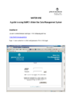
This document is a step-by-step guide which assists consent holders to use GWRC Water Use Data Management System. Read more here
date_range Published 08 Mar 2022
Download now (PDF 439 KB) get_appWater Use Records Spreadsheet Template
This document is a template form for water use records for the 2024/25 financial year. Read more here
date_range Published 08 Nov 2024
Download now (XLSX 29 KB) get_appApplication for one-off exemption for alternative verification methodology for water take consent holders
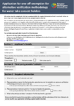
This application form is required for consent holders applying for a one-off exemption to completing an approved water meter verification method. The form must be accompanied by a proposal for… Read more here
date_range Published 25 Mar 2024
Download now (PDF 179 KB) get_appAccredited Service Providers
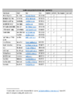
This document outlines all the accredited service providers within the Wellington Region. Read more here
date_range Published 01 Dec 2020
Download now (PDF 184 KB) get_appAquifer Test Guidelines
This document outlines the guidelines for aquifer tests within the Greater Wellington Region. These guidelines will need to be followed in the investigation and preparation of resource consent applications for… Read more here
date_range Published 01 Jul 2012
Download now (PDF 1.1 MB) get_appAquifer Test Analysis Tool
This workbook contains analytical solutions that can be used to analyse data from constant rate pumping tests performed in various hydrogeological settings; and can be used to predict changes in… Read more here
date_range Published 08 Mar 2022
Download now (XLS 12 MB) get_appNatural wetland photo point monitoring protocol
date_range Published 19 Sep 2022
Download now (PDF 2.5 MB) get_appSee the Ministry for the Environment website for detailed information on the measure and reporting of water takes amendment regulations.
Upload your water meter readings through the GWRC Water Use website.
View the Irrigation NZ website for the full list of accredited installers and verifiers.
Regulations for measuring and reporting consumptive water take consents came into force in 2010 and were updated in 2020. In summary they require:
- A water measuring device (water meter) to be installed on all water takes greater than 5 litres/sec
- Any water measuring device to be verified at least once every five years
- Consent holders to install a telemetry system on any water meter that submits water use data to us each day. (Note for water takes between 5 and 10 litres/sec a telemetry system is not required to be installed until September 2026.)
The Regulations are the minimum requirements for measuring and reporting water takes. It is important that you are familiar with your consent conditions as they may be stringent that the Regulations. Conversely if your consent conditions are less stringent, you will still need to comply with the Regulations. Find out more about measuring and reporting water takes. (PDF 545 KB)
We support the Water Measurement ‘Blue Tick’ Accreditation Programme managed by Irrigation NZ. This programme identifies accredited service providers for installing and verifying water meters, and managing water use data. Using an accredited service provider gives confidence to water take consent holders that any water measurement is completed to a high standard and in accordance with best practice and minimum standards. See the list of accredited service provided in our region. (PDF 184 KB)
Clamp-on verifications are no longer an approved methodology for verifying water meters in the our region, except under limited circumstances requiring GW approval (PDF 179 KB) . An in-line, test rig or bypass verification methodology is now required, in accordance with Irrigation NZ best practice recommendations.
If you are not required to provide telemetered water use data by the Regulations or your consent conditions, you can submit water use data in either of the following two ways:
- Downloading and recording water meter readings using this template.
- Inputting water meter readings directly into our Water Use Data Management System. Read a guide on how to use this method. (PDF 439 KB)
Many water take consents have consent conditions that restrict water use during periods of low river and stream flows. Restrictions can be partial (i.e. the amount of water taken is required to be reduced) or full (i.e. no water is allowed to be taken). It is the consent holder’s responsibility to be fully informed and take appropriate actions of any partial and/or full water restrictions identified in their water take consent conditions based on the current status of river and stream flows identified on our website. All directions and the current status of all river and stream flows in our region are outlined below:
Notes:
- All directions from Greater Wellington Regional Council for water restrictions for the 2024-2025 irrigation season are provided in the list of consents for each catchment in the table below.
- The flow for compliance purposes (for GWRC real time monitoring sites) is determined after midnight each day and applies from 9am for the following 24 hours.
| Catchment | List of consents | Real time monitoring site | Restrictions that apply to most water take consent holders |
| Kopuaranga | Surface water takes (PDF 134 KB) | Kopuaranga @ Palmers Bridge | No restrictions when flow above 270 l/sec (0.27m3/sec) Full restrictions (cease take) when flow less than 270 l/sec (0.27m3/sec) |
| Taueru | Surface water takes (PDF 127 KB) | Taueru @ Te Whiti Bridge | No restrictions above 250 l/sec (0.25m3/sec) Partial restrictions when flow less than 250 l/sec (0.25m3/sec) but above 185 l/sec (0.185m3/sec) Full restrictions (cease take) when flow less than 185 l/sec (0.185m3/sec) |
| Makahakaha | Surface water takes (PDF 129 KB) |
Makahakaha @ Gladstone Rd eastern culvert Monitoring site is in the process of being recommissioned |
No restrictions above 44 l/sec (0.045 m3/sec). Partial restrictions when flow less than 44 l/sec (0.044 m3/sec) but above 33 l/sec (0.033m3/sec) Full restrictions (cease take) when flow less than 33 l/sec (0.0.33m3/sec) |
| Pahaoa | Surface water takes (PDF 128 KB) | Pahaoa River @ Hinakura | No restrictions above 160 l/sec (0.16 m3/sec) Partial restrictions when flow less than 160 l/sec (0.16 m3/sec) but above 100 l/sec (0.1 m3/sec) Full restrictions (cease take) when flow less than 100 l/sec (0.1 m3/sec) |
| Huangarua and Ruakokopatuna | Surface water takes (PDF 138 KB) | Various - see list of consents table |
Notes:
- All directions from Greater Wellington Regional Council for water restrictions for the 2024-2025 irrigation season are provided in the list of consents for each catchment in the table below.
2. The flow for compliance purposes (for GWRC real time monitoring sites) is determined after midnight each day and applies from 9am for the following 24 hours.
| Catchment | List of consents | Real time monitoring site | Restrictions that apply to most water take consent holders |
| Upper Ruamahanga | Surface water takes (PDF 190 KB) | Ruamahanga @ Wardells Bridge |
Full restrictions (cease take) for some consents below 5000 l/sec (5.0m3/sec) Partial restrictions when flow less than 2700 l/sec (2.7m3/sec) but above 2400 l/sec (2.4m3/sec) Full restrictions (cease take) when flow less than 2400 l/sec (2.4m3/sec) |
| Upper Ruamahanga | Groundwater takes (PDF 201 KB) | Ruamahanga @ Wardells Bridge | No restrictions when flow above 2400 l/sec (2.4m3/sec) Partial restrictions when flow less than 2400 l/sec (2.4m3/sec) |
| Lower Ruamahanga | Surface water takes (PDF 192 KB) | Ruamahanga @ Waihenga | No restrictions above 9200 l/sec (9.2m3/sec) Partial restrictions when flow less than 9200 l/sec (9.2m3/sec) but above 8500 l/sec (8.5m3/sec) Full restrictions (cease take) when flow less than 8500 l/sec (8.5m3/sec) |
| Lower Ruamahanga | Groundwater takes (PDF 188 KB) | Ruamahanga @ Waihenga | No restrictions above 8500 l/sec (8.5m3/sec) Partial restrictions when flow less than 8500 l/sec (8.5m3/sec) |
| Masterton streams | Surface water takes (PDF 159 KB) | Makoura @ Colombo Rd | Check each consent in list of consents |
| Parkvale & Booths | Surface water takes (PDF 138 KB) | Parkvale @ Renalls weir and Booths Creek @ Andersons Line | Check each consent in list of consents |
| Papawai | Ground & surface water takes (PDF 131 KB) | Papawai @ Fabians Rd | Check each consent in list of consents |
| Otakura | Surface water takes (PDF 129 KB) | Otukura @ weir | No restrictions above 95 l/sec (0.095m3/sec) Full restrictions (cease take) when flow less than 95 l/sec (0.095m3/sec) |
| Tauherenikau Drains & Dock Creek | Ground & surface water takes (PDF 138 KB) | Check each consent in list of consents |
Notes:
- All directions from Greater Wellington Regional Council for water restrictions for the 2024-2025 irrigation season are provided in the list of consents for each catchment in the table below.
2. The flow for compliance purposes (for GWRC real time monitoring sites) is determined after midnight each day and applies from 9am for the following 24 hours.
| Catchment | List of consents | Real time monitoring sites | Restrictions that apply to most water take consent holders |
| Waipoua | Ground & surface water takes (PDF 135 KB) | Waipoua @ Mikimiki Bridge |
Full restrictions (cease take) for some consents below 1000 l/sec (1.0m3/sec) Partial restrictions when flow less than 300 l/sec (0.3 m3/sec) but above 250 l/sec (0.25 m3/sec) Full restrictions (cease take) when flow less than 250 l/sec (0.25 m3/sec) |
| Waingawa | Ground & surface water takes (PDF 141 KB) | Waingawa @ Kaituna | No restrictions above 1900 l/sec (1.9m3/sec) Partial restrictions when flow less than 1900 l/sec (1.9m3/sec) but above 1100 l/sec (1.1m3/sec) Full restrictions (cease take) when flow less than 1100 l/sec (1.1m3/sec) |
| Upper Mangatarere | Surface water takes (PDF 158 KB) | Mangatarere @ Gorge | No restrictions above 330 l/sec (0.33m3/sec) Partial restrictions when flow less than 330 l/sec (0.33m3/sec) but above 240 l/sec (0.24m3/sec) Full restrictions (cease take) when flow less than 240 l/sec (0.24m3/sec) |
| Lower Mangatarere | Ground & surface water takes (PDF 158 KB) | Mangatarere @ Gorge | Check each consent in list of consents |
| Waiohine | Surface water takes (PDF 128 KB) | Waiohine @ Gorge | No restrictions above 3040 l/sec (3.040m3/sec) Full restrictions (cease take) when flow less than 3040 l/sec (3.040m3/sec) |
| Waiohine | Ground water takes (PDF 138 KB) | Waiohine @ Gorge | No restrictions above 3,395 l/sec (3.395m3/sec) Partial restrictions when flow less than 3,395 l/sec (3.395m3/sec) |
| Tauherenikau & related catchments | Surface water takes (PDF 134 KB) | Tauherenikau @ Gorge | No restrictions above 1300 l/sec (1.30 m3/sec) Partial restrictions when flow less than 1300 l/sec (1.30 m3/sec) |
| Tauherenikau & related catchments | Ground water takes (PDF 137 KB) | Tauherenikau @ Gorge | No restrictions above 1350 l/sec (1.35 m3/sec) Partial restrictions when flow less than 1350 l/sec (1.35 m3/sec) |
| Lake Wairarapa | Surface water takes (PDF 180 KB) | Lake Wairarapa @ Burlings and Tauherenikau @ Gorge | GWRC will notify water take consent holders of any restrictions |
| Wharepapa | Ground water takes (PDF 65 KB) | No real time monitoring site | Check each consent in list of consents |
Notes:
- All directions from Greater Wellington Regional Council for water restrictions for the 2024-2025 irrigation season are provided in the list of consents for each catchment in the table below.
2. The flow for compliance purposes (for GWRC real time monitoring sites) is determined after midnight each day and applies from 9am for the following 24 hours.
Wellington
| Catchment | List of consents | Real time monitoring site | Restrictions that apply to most water take consent holders |
| Hutt | Surface water takes (PDF 130 KB) | Hutt @ Birchville | No restrictions above 1200 l/sec (1.2 m3/sec) Partial restrictions and Full restrictions (cease take) when flow less than 1200 l/sec (1.2m3/sec) |
| Wainuiomata | Surface water takes (PDF 126 KB) | Wainuiomata @ Leonard Wood Park |
No restrictions above 300 l/sec (0.3 m3/sec) Full restrictions (cease take) when flow less than 300 l/sec (0.3 m3/sec) |
| Gollans Stream | Surface water takes (PDF 125 KB) | No real time monitoring site | GWRC will notify water take consent holders of any restrictions following flow measurement |
Porirua
| Catchment | List of consents | Real time monitoring site | Restrictions that apply to most water take consent holders |
| Pauatahanui and Horokiwi | Surface water takes (PDF 129 KB) | Variable - see lists of consents table |
Notes:
1. All directions from Greater Wellington Regional Council for water restrictions for the 2024-2025 irrigation season are provided in the list of consents for each catchment in the table below.
2. The flow for compliance purposes (for GWRC real time monitoring sites) is determined after midnight each day and applies from 9am for the following 24 hours.
| Catchment | List of consents | Real time monitoring site | Restrictions that apply to most water take consent holders |
| Otaki | Surface water takes (PDF 174 KB) | Otaki @ Pukehinau | Check consent in list of consents |
| Waikanae | Surface water takes (PDF 127 KB) | Waikanae @ water treatment plant | Check consent in list of consents |
| Waimeha | Surface water takes (PDF 125 KB) | No real time monitoring site | GWRC will notify water take consent holders of any restrictions following flow measurement |
| Mangaone | Surface water takes (PDF 125 KB) | Mangaone @ Ratanui | No restrictions above 50 l/sec (0.05m3/sec) Full restrictions (cease take) when flow less than 50 l/sec (0.05m3/sec) |
| Waitohu | Ground water takes (PDF 166 KB) | Waitohu Stream @ Water Supply Intake | No restrictions above 185 l/sec (0.185 m3/sec) Partial restrictions when flow less than 185 l/sec (0.185 m3/sec) and 140 l/sec (0.140 m3/sec) |
| Wharemauku | Surface water takes (PDF 66 KB) | Wharemauku Stream@Coastlands | Check consent in list of consents |
Get in touch
- Phone:
- 0800496734
- Email:
- info@gw.govt.nz